

SIST EN 4709-007:2026
(Main)Aerospace series - Unmanned Aircraft Systems - Part 007: General product requirements for UAS of classes C5 and C6
- Abstract
This document provides technical specification and specifies verification methods to support compliance with Commission Delegated Regulation (EU) 2019/945 of 12 March 2019 amended by Commission Delegated Regulation (EU) 2020/1058 of 27 April 2020 on unmanned aircraft systems (UAS) and on third-country operators of unmanned aircraft systems.
This includes compliance with product requirements for UAS intended to be operated under a standard scenario in the ‘specific’ category (class C5 and class C6 UAS).
This document is only applicable for unmanned aircraft (UA) with energy sources based on electro-chemical technologies.
Additional hazards that occur from the characteristics of the payload are excluded and are under the responsibility of the manufacturer and operator.
The present document covers requirements expressed in Annex, Part 16 requirements (1), (3), (4) and (6) and Part 17 requirements (1), (3), (6) and (7) of the Regulation 2020/1058.
- Status
- Published
- Public Enquiry End Date
- 29-Jan-2024
- Publication Date
- 20-Oct-2026
- Technical Committee
- I13 - Imaginarni 13
- Current Stage
- 6060 - National Implementation/Publication (Adopted Project)
- Start Date
- 19-Oct-2026
- Due Date
- 24-Dec-2026
- Completion Date
- 21-Oct-2026

SIST EN 4709-007 is a standard in the Aerospace series for Unmanned Aircraft Systems (UAS). It specifies technical product requirements and verification methods for UAS classes C5 and C6, to support compliance with Commission Delegated Regulation (EU) 2019/945 as amended. It is aimed at manufacturers, test labs, and compliance teams that need to show the product meets the class-specific UAS requirements.
What does SIST EN 4709-007 specify?
SIST EN 4709-007 sets the product requirements and test methods for UAS intended to be operated under a standard scenario in the ‘specific’ category, specifically class C5 and class C6 UAS. It also links those requirements to the relevant parts of Commission Delegated Regulation (EU) 2020/1058, so the document is used as a technical route to demonstrate conformity.
The scope is limited to unmanned aircraft (UA) with energy sources based on electro-chemical technologies. It excludes additional hazards caused by payload characteristics, which remain the responsibility of the manufacturer and operator. It also excludes UAS intended for the ‘Specific’ or ‘Certified’ categories and UAS lighter than air, such as airships and balloons.
The document is organized into:
- Clause 1 - Scope
- Clause 2 - Normative references
- Clause 3 - Terms and definitions
- Clause 4 - Product requirements and compliance for class C5 UAS
- Clause 5 - Product requirements and compliance for class C6 UAS
- Informative annexes A to D and Annex ZA
| Annex | What it covers |
|---|---|
| Annex A | Signal strength examples for digital, analog, and cellular C2 links |
| Annex B | Examples of graphical interfaces showing UA geographical position |
| Annex C | Colour and size recommendations for alerts, plus verification guidance |
| Annex D | Example ways to program the UA trajectory |
| Annex ZA | Relationship with the essential requirements of Delegated Regulation (EU) 2019/945 |
What are the key requirements of SIST EN 4709-007?
SIST EN 4709-007 separates the requirements for class C5 and class C6 UAS, and each class has its own set of operational and interface expectations. In practice, the document focuses on what the remote pilot must be able to see, control, and verify during flight, and on how those functions are checked.
Class C5 requirements
Clause 4 requires that, unless the UA is tethered, a class C5 UA must not be equipped with fixed wings. The verification is by visual inspection, so the design itself has to be checked, not just the flight behavior.
Clause 4 also requires a selectable low-speed mode that limits ground speed to not more than 5 m/s, unless the UA is tethered. The manufacturer’s instructions must explain how to set the speed, activate and deactivate the mode, and what conditions or limitations affect it. This matters because the remote pilot needs a controlled low-speed option for constrained operations.
Clause 4.4 requires command-and-control (C2) link monitoring and alerting. The system must show at least four signal-strength states - strong, medium, weak, and loss of C2 link - and must provide caution and warning alerts, with visual signals and aural and/or haptic alerts where required. The manufacturer must define the thresholds and describe the signals in the instructions, because operators need clear and distinguishable alerts when the link quality changes.
Clause 4.4 also sets out verification by repeated tests of the signal indication, the caution and warning alerts, and the relationship between the displayed signal state and the actual link quality. In practice, this means the remote-control interface has to track link degradation in a way that reflects what the pilot can actually rely on.
Class C6 requirements
Clause 5.1 requires the manufacturer to declare the maximum ground speed in level flight, and the declared value must not exceed 50 m/s. The measured ground speed in horizontal flight must not exceed that declared limit. This gives buyers and assessors a clear speed ceiling to check against the manufacturer’s stated capability.
Clause 5.2 requires the geographical position, speed, and height of the UA to be updated at least every second. The remote-control interface must display the UA position, the take-off point or remote pilot position, a selectable or variable scale, and an orientation reference or other orientation aid. For practical use, this means the pilot needs a map-based display that is current enough for live control.
Clause 5.2 also requires the display of coordinates, speed, and height to be clear and usable. The document sets expectations for coordinate format, icon visibility, and the way accuracy is shown, including worst-case displacement where needed. That matters because the pilot must be able to understand where the UA is, how fast it is moving, and how uncertain the displayed position may be.
Clause 5.3 requires a means to program the UA trajectory. The remote pilot must be able to set ordered waypoints, have routes automatically created between waypoints, and define the height at each waypoint. The system must warn the remote pilot if the flight plan exceeds the flight envelope, and the instructions must explain how to use the function.
Clause 5.3 verification checks that the programmed trajectory is consistent with the selected waypoints and that the height at each waypoint stays within the defined tolerance. In practice, this is the part that links route planning in the control station to what the UA actually flies.
Shared items for C5 and C6
Clause 5.4 points back to the C2 link monitoring and alerting requirements in Clause 4.4. That means the same link-monitoring logic and alert behavior applies across both class families.
What terms does SIST EN 4709-007 define?
- alert - an indication on the remote-control equipment that draws the remote pilot’s attention to a non-normal operational or system condition.
- caution - an alert level for conditions that need immediate awareness, but not as urgent a response as a warning.
- warning - an alert level for conditions that need immediate awareness and immediate remote pilot response.
- haptic signal - a vibration-type signal delivered through handheld control equipment.
- nominal mode - the basic operating mode used in normal operation, without loss of function or degraded performance.
- controlled ground area - an area where the UAS is operated and only involved persons are present.
- positioning system - the instrumental and computational system used to determine position.
- global navigation satellite system (GNSS) - a satellite system used to determine location anywhere in the world.
Who uses SIST EN 4709-007?
SIST EN 4709-007 is used by UAS manufacturers, remote-control system designers, test laboratories, and conformity-assessment teams. It is also useful for quality managers and buyers who need to specify C5 or C6 capabilities in procurement or product acceptance.
In practice, these users rely on the standard when designing low-speed modes, C2 link alerts, position and height displays, and trajectory programming functions. Certification and regulatory teams use it to check whether the product evidence supports the relevant UAS class requirements.
Which standards are used with SIST EN 4709-007?
- EN 4709-001 - provides the base product requirements and verification methods that this part refers to for shared test approaches and measurement checks.
- EN 4709-005 - provides the verification method for the Geocaging function, which is referenced for the graphical interface and related flight checks.
What does the SIST EN 4709-007 document contain?
The document contains detailed performance requirements, verification methods, and pass criteria for class C5 and class C6 UAS. It also includes test approaches that use visual inspection, flight tests, display recording, and analysis of measured data.
Annex A gives examples of how signal strength can be interpreted for digital, analog, and cellular C2 links. Annex B shows example graphical interfaces for displaying UA geographical position, while Annex C gives colour and size recommendations for alerts and explains how to verify them. Annex D gives an example of how to program the UA trajectory, and Annex ZA maps the document clauses to the essential requirements of Delegated Regulation (EU) 2019/945.
Relations
- Effective Date
- 21-Oct-2026
- Effective Date
- 21-Oct-2026
- Effective Date
- 21-Oct-2026
Get Certified
Connect with accredited certification bodies for this standard

BSI Group
BSI (British Standards Institution) is the business standards company that helps organizations make excellence a habit.

Bureau Veritas
Bureau Veritas is a world leader in laboratory testing, inspection and certification services.

DNV
DNV is an independent assurance and risk management provider.
Sponsored listings
Frequently Asked Questions
SIST EN 4709-007:2026 is a standard published by the Slovenian Institute for Standardization (SIST). Its full title is "Aerospace series - Unmanned Aircraft Systems - Part 007: General product requirements for UAS of classes C5 and C6". This standard covers: This document provides technical specification and specifies verification methods to support compliance with Commission Delegated Regulation (EU) 2019/945 of 12 March 2019 amended by Commission Delegated Regulation (EU) 2020/1058 of 27 April 2020 on unmanned aircraft systems (UAS) and on third-country operators of unmanned aircraft systems. This includes compliance with product requirements for UAS intended to be operated under a standard scenario in the ‘specific’ category (class C5 and class C6 UAS). This document is only applicable for unmanned aircraft (UA) with energy sources based on electro-chemical technologies. Additional hazards that occur from the characteristics of the payload are excluded and are under the responsibility of the manufacturer and operator. The present document covers requirements expressed in Annex, Part 16 requirements (1), (3), (4) and (6) and Part 17 requirements (1), (3), (6) and (7) of the Regulation 2020/1058.
This document provides technical specification and specifies verification methods to support compliance with Commission Delegated Regulation (EU) 2019/945 of 12 March 2019 amended by Commission Delegated Regulation (EU) 2020/1058 of 27 April 2020 on unmanned aircraft systems (UAS) and on third-country operators of unmanned aircraft systems. This includes compliance with product requirements for UAS intended to be operated under a standard scenario in the ‘specific’ category (class C5 and class C6 UAS). This document is only applicable for unmanned aircraft (UA) with energy sources based on electro-chemical technologies. Additional hazards that occur from the characteristics of the payload are excluded and are under the responsibility of the manufacturer and operator. The present document covers requirements expressed in Annex, Part 16 requirements (1), (3), (4) and (6) and Part 17 requirements (1), (3), (6) and (7) of the Regulation 2020/1058.
SIST EN 4709-007:2026 is classified under the following ICS (International Classification for Standards) categories: 49.020 - Aircraft and space vehicles in general. The ICS classification helps identify the subject area and facilitates finding related standards.
SIST EN 4709-007:2026 has the following relationships with other standards: It is inter standard links to SIST EN 4709-001:2026, SIST EN 4709-003:2026, SIST EN 4709-005:2026. Understanding these relationships helps ensure you are using the most current and applicable version of the standard.
SIST EN 4709-007:2026 is associated with the following European legislation: EU Directives/Regulations: 2019/945; Standardization Mandates: M/567. When a standard is cited in the Official Journal of the European Union, products manufactured in conformity with it benefit from a presumption of conformity with the essential requirements of the corresponding EU directive or regulation.
SIST EN 4709-007:2026 is available in PDF format for immediate download after purchase. The document can be added to your cart and obtained through the secure checkout process. Digital delivery ensures instant access to the complete standard document.
Standards Content (Sample)
SLOVENSKI STANDARD
01-december-2026
Aeronavtika - Letalski sistemi brez posadke - 007. del: Splošne zahteve za
proizvode za UAS razredov C5 in C6
Aerospace series - Unmanned Aircraft Systems - Part 007: General product
requirements for UAS of classes C5 and C6
Luft- und Raumfahrt - Unbemannte Luftfahrzeugsysteme - Teil 007: Allgemeine
Produktanforderungen für UAS der Klassen C5 und C6
Série aérospatiale - Aéronefs télépilotés - Partie 007 : Exigences produit générales pour
les classes d'UAS C5 et C6
Ta slovenski standard je istoveten z: EN 4709-007:2026
ICS:
49.020 Letala in vesoljska vozila na Aircraft and space vehicles in
splošno general
2003-01.Slovenski inštitut za standardizacijo. Razmnoževanje celote ali delov tega standarda ni dovoljeno.
EN 4709-007
EUROPEAN STANDARD
NORME EUROPÉENNE
October 2026
EUROPÄISCHE NORM
ICS 49.020
English Version
Aerospace series - Unmanned Aircraft Systems - Part 007:
General product requirements for UAS of classes C5 and
C6
Série aérospatiale - Aéronefs télépilotés - Partie 007 : Luft- und Raumfahrt - Unbemannte
Exigences produit générales pour les classes d'UAS C5 Luftfahrzeugsysteme - Teil 007: Allgemeine
et C6 Produktanforderungen für UAS der Klassen C5 und C6
This European Standard was approved by CEN on 16 February 2026.
CEN members are bound to comply with the CEN/CENELEC Internal Regulations which stipulate the conditions for giving this
European Standard the status of a national standard without any alteration. Up-to-date lists and bibliographical references
concerning such national standards may be obtained on application to the CEN-CENELEC Management Centre or to any CEN
member.
This European Standard exists in three official versions (English, French, German). A version in any other language made by
translation under the responsibility of a CEN member into its own language and notified to the CEN-CENELEC Management
Centre has the same status as the official versions.
CEN members are the national standards bodies of Austria, Belgium, Bulgaria, Croatia, Cyprus, Czech Republic, Denmark, Estonia,
Finland, France, Germany, Greece, Hungary, Iceland, Ireland, Italy, Latvia, Lithuania, Luxembourg, Malta, Netherlands, Norway,
Poland, Portugal, Republic of North Macedonia, Romania, Serbia, Slovakia, Slovenia, Spain, Sweden, Switzerland, Türkiye and
United Kingdom.
EUROPEAN COMMITTEE FOR STANDARDIZATION
COMITÉ EUROPÉEN DE NORMALISATION
EUROPÄISCHES KOMITEE FÜR NORMUNG
CEN-CENELEC Management Centre: Rue de la Science 23, B-1040 Brussels
© 2026 CEN All rights of exploitation in any form and by any means reserved Ref. No. EN 4709-007:2026 E
worldwide for CEN national Members.
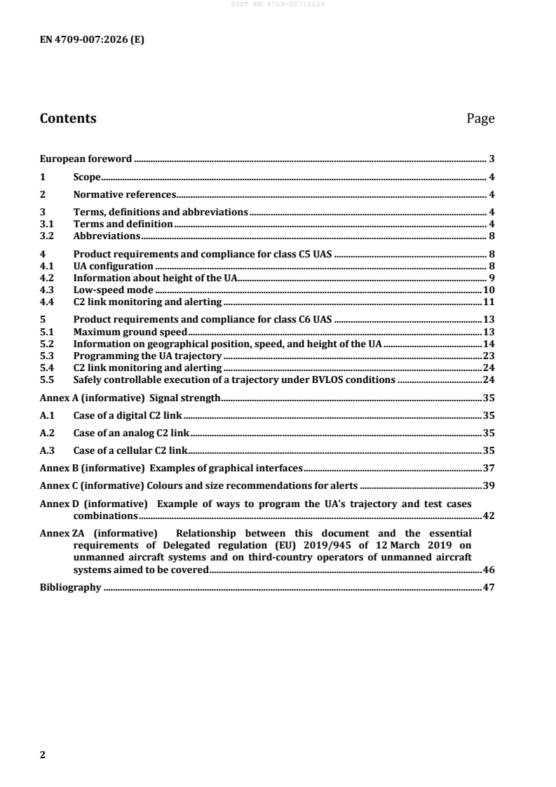
Contents Page
European foreword . 3
1 Scope . 4
2 Normative references . 4
3 Terms, definitions and abbreviations . 4
3.1 Terms and definition . 4
3.2 Abbreviations . 8
4 Product requirements and compliance for class C5 UAS . 8
4.1 UA configuration . 8
4.2 Information about height of the UA . 9
4.3 Low-speed mode . 10
4.4 C2 link monitoring and alerting . 11
5 Product requirements and compliance for class C6 UAS . 13
5.1 Maximum ground speed . 13
5.2 Information on geographical position, speed, and height of the UA . 14
5.3 Programming the UA trajectory . 23
5.4 C2 link monitoring and alerting . 24
5.5 Safely controllable execution of a trajectory under BVLOS conditions . 24
Annex A (informative) Signal strength . 35
A.1 Case of a digital C2 link . 35
A.2 Case of an analog C2 link . 35
A.3 Case of a cellular C2 link . 35
Annex B (informative) Examples of graphical interfaces . 37
Annex C (informative) Colours and size recommendations for alerts . 39
Annex D (informative) Example of ways to program the UA's trajectory and test cases
combinations . 42
Annex ZA (informative) Relationship between this document and the essential
requirements of Delegated regulation (EU) 2019/945 of 12 March 2019 on
unmanned aircraft systems and on third-country operators of unmanned aircraft
systems aimed to be covered . 46
Bibliography . 47
European foreword
This document (EN 4709-007:2026) has been prepared by Technical Committee
CEN/TC 471 “Unmanned Aircraft Systems”, the secretariat of which is held by BNAE.
This European Standard shall be given the status of a national standard, either by publication of an
identical text or by endorsement, at the latest by April 2027, and conflicting national standards shall be
withdrawn at the latest by April 2027.
Attention is drawn to the possibility that some of the elements of this document may be the subject of
patent rights. CEN shall not be held responsible for identifying any or all such patent rights.
This document has been prepared under a standardization request addressed to CEN by the European
Commission. The Standing Committee of the EFTA States subsequently approves these requests for its
Member States.
For the relationship with EU Legislation, see informative Annex ZA, which is an integral part of this
document.
Any feedback and questions on this document should be directed to the users’ national standards body.
A complete listing of these bodies can be found on the CEN website.
According to the CEN-CENELEC Internal Regulations, the national standards organisations of the
following countries are bound to implement this European Standard: Austria, Belgium, Bulgaria,
Croatia, Cyprus, Czech Republic, Denmark, Estonia, Finland, France, Germany, Greece, Hungary, Iceland,
Ireland, Italy, Latvia, Lithuania, Luxembourg, Malta, Netherlands, Norway, Poland, Portugal, Republic of
North Macedonia, Romania, Serbia, Slovakia, Slovenia, Spain, Sweden, Switzerland, Türkiye and the
United Kingdom.
1 Scope
This document provides technical specification and specifies verification methods to support
compliance with Commission Delegated Regulation (EU) 2019/945 of 12 March 2019 amended by
Commission Delegated Regulation (EU) 2020/1058 of 27 April 2020 on unmanned aircraft systems
(UAS) and on third-country operators of unmanned aircraft systems.
This includes compliance with product requirements for UAS intended to be operated under a standard
scenario in the ‘specific’ category (class C5 and class C6 UAS).
This document is only applicable for unmanned aircraft (UA) with energy sources based on electro-
chemical technologies.
Additional hazards that occur from the characteristics of the payload are excluded and are under the
responsibility of the manufacturer and operator.
The present document covers requirements expressed in Annex, Part 16 requirements (1), (3), (4) and
(6) and Part 17 requirements (1), (3), (6) and (7) of the Regulation 2020/1058.
2 Normative references
The following documents are referred to in the text in such a way that some or all of their content
constitutes requirements of this document. For dated references, only the edition cited applies. For
undated references, the latest edition of the referenced document (including any amendments) applies.
EN 4709-001:2026, Aerospace series — Unmanned Aircraft Systems — Part 001: Product requirements
and verification
EN 4709-003:2026, Aerospace series — Unmanned Aircraft Systems — Part 003: Geo-awareness
requirements
3 Terms, definitions and abbreviations
3.1 Terms and definition
For the purposes of this document, the terms and definitions given in EN 4709-001:2026 and the
following apply.
ISO and IEC maintain terminology databases for use in standardization at the following addresses:
— ISO Online browsing platform: available at https://www.iso.org/obp/
— IEC Electropedia: available at https://www.electropedia.org/
3.1.1
alert
indication on the equipment to control the UA remotely meant to attract the attention of and identify to
the remote pilot a non-normal operational or system condition
Note 1 to entry: Alerts are classified at levels or categories corresponding to Warning and Caution.
Note 2 to entry: Alert indications also include non-normal range markings.
3.1.2
caution
level or category of alert for conditions that require immediate remote pilot awareness and a less
urgent subsequent remote pilot response than a warning alert
3.1.3
haptic signal
type of signal that is transferred to the hand of the user through the handheld equipment to control the
UA remotely in the form of vibrations
3.1.4
nominal mode
basic mode of operation encountered in normal operation in the absence of any loss of features,
functions or capabilities, or degradation of performance
[SOURCE: EN 4709-001:2026]
3.1.5
degraded mode
any temporary, persistent, or permanent reduction in features, functions, and capabilities, including the
ability to cope with adverse environmental conditions outside of the limitations of the service envelope
defined by the manufacturer likely to occur when operating close to or at those limitations
Note 1 to entry: Such limitations are (but not limited to): GNSS reception due to satellite constellation,
ionospheric disturbances, jamming, etc.; magnetic deviation and disturbance affecting the compass
(magnetometer); data link quality, in terms of latency, bandwidth, availability and integrity.
Note 2 to entry: Failures of one or, if applicable, more systems relevant for stability, controllability and remote
pilot workload, such as (if required) accelerometers, gyroscopes, airspeed sensors, engine speed sensors,
electrical power supply systems (batteries), power distribution systems (harnesses, connectors, voltage
converters, fuses, etc.), and systems relevant for health monitoring such as internal temperatures and battery
status, that are likely to occur during the life of the product are taken into account.
[SOURCE: EN 4709-001:2026]
3.1.6
warning
level or category of alert for conditions that require immediate remote pilot awareness and immediate
remote pilot response
3.1.7
orientation reference
reference providing the orientation or direction of a given map with respect to the directions on the
ground or any other reference specified by the manufacturer
EXAMPLE Magnetic north.
3.1.8
controlled ground area
ground area where the UAS is operated and within which the UAS operator can ensure that only
involved persons are present
3.1.9
positioning system
system of instrumental and computational components for determining position
EXAMPLE Inertial, integrated, linear, optical and satellite positioning systems.
3.1.10
view
visual content displayed on the graphical interface, which allows the adjustable display of all the
required and supportive visual information by the usage of different windows and zoom levels
3.1.11
field of view
geographical area that is currently displayed on the view
3.1.12
total station
electronic tachymeter
tachymeter with microprocessor(s), display and memory for opto-electronic distance measurement,
angle reading, processing, displaying and storing of measurement data
[SOURCE: ISO 9849:2017, 3.1.20]
3.1.13
global navigation satellite system
GNSS
system that comprises several networks of satellites that transmit radio signals containing time and
distance data that can be picked up by a receiver, allowing the user to identify the location of the
receiver anywhere around the world
[SOURCE: ISO 7078:2020, 3.1.26]
3.1.14
GNSS receiver
electronic device that receives and digitally processes signals from GNSS satellites in order to provide
position, velocity and time (of the receiver)
[SOURCE: ISO 7078:2020, 3.5.27]
3.1.15
clear and concise information
extent to which an information is presented
Note 1 to entry: the information considered in this document is the geographical position of the UA, its speed and
its height above the surface or take-off point according to Commission Delegated Regulation (EU) 2020/1058 of
27 April 2020 Annex, Part 16 and Part 17.
Note 2 to entry: the attributes considered are visibility, character height, object size, syntax for physical
quantities and units and accuracy.
3.1.16
scale factor
factor by which the coordinates of all defined points of the symbol will be enlarged or reduced in size in
relation to the reference point of the symbol
[SOURCE: EN 81714-2:2007, 3.4.2]
3.1.17
Beyond Visual Line Of Sight
BVLOS
type of UAS operation which is not conducted in VLOS
[SOURCE: Commission Delegated Regulation (EU) 2019/947 of 4 April 2022, Article 2, No. (8)]
3.1.18
operational mode
mode used to categorize the level of interaction between remote pilot and UAS (cf. EN 81714-2:2007):
− automatic mode
− semi-automatic mode
− manual mode
Note 1 to entry: The expression “operational mode” is used to address safety relevant control issues.
[SOURCE: NSO AEP-83 (STANAG 4703), Edition B Version 1, UL47.1]
3.1.19
automatic mode
operational mode where UA attitude, speed and flight path are fully controlled by the flight control
system, however the remote pilot is always able to take control, when needed
Note 1 to entry: No remote pilot input is needed to address flight controls and vehicle steering, other than to
change the operational mode, load or modify the required flight plan or waypoint parameters.
EXAMPLE Waypoint path navigation, waypoint holding (hovering/loitering), automatic take-off, automatic
landing, follow-me mode, return to home, etc.
[SOURCE: EN 4709-001:2026]
3.1.20
semi-automatic mode
operational mode where the remote pilot commands outer loop parameters such as altitude, heading
and air speed
Note 1 to entry: This is an assisted manual mode where the flight control system operates the UA controls to
achieve the commanded outer loop parameter value. Envelope flight protection and/or control decoupling
functions should be in place in this control operational mode. The flight manual clearly specifies, for any
possible/available control mode that is classified as semi-automatic, for each degree of freedom, the level of
involvement of the remote pilot to address control stability.
Note 2 to entry: A wide range of flight control modes are semi-automatic, from low level attitude/rate control,
autopilot heading/speed/altitude control, velocity control; position control may be considered semi-automatic if
remote pilot input is transformed into position commands continuously (or an automatic mode if remote pilot
inputs only modify waypoint coordinates in on-board autopilot)
[SOURCE: EN 4709-001:2026]
3.1.21
manual mode
operational mode where the remote pilot directly commands UA controls
EXAMPLE Aerodynamic surfaces through servo-actuators and engine through electronic speed control.
Note 1 to entry: This is an unassisted direct piloting manual mode. This operational mode does not benefit from
autopilot aiding action (e.g. flight envelope protection) in excess of stability augmentation.
3.2 Abbreviations
This clause lists the abbreviated terms used in the present document.
BVLOS Beyond Visual Line Of Sight
CEP Circular Error Probability
GNSS Global Navigation Satellite System
RTK Real Time Kinematic
UA Unmanned Aircraft
UAS UA System
RTH Return To Home
4 Product requirements and compliance for class C5 UAS
4.1 UA configuration
4.1.1 Design requirements
Unless the UA is tethered, the UA shall not be equipped with fixed wings, whether or not equipped with
VTOL capabilities.
4.1.2 Design verification
Unless tethered, verify by visual inspection that the UA is not equipped with fixed wings.
4.1.3 Pass criteria
The UA is not equipped with fixed wings.
4.2 Information about height of the UA
4.2.1 Performance requirements
4.2.1.1 Update rate
The height of the UA shall be updated at least every second.
4.2.1.2 Height of the UA
The height information on the equipment to control the UA remotely shall not be hidden and shall
comprise the name or symbol for the physical quantity followed by the measured value and the unit.
The information given shall be explained in the manufacturer’s instructions followed by a description,
whether the height is above the surface or the take-off point.
4.2.2 Verification method
4.2.2.1 Update rate
4.2.2.1.1 General
Determine the update rate by the test method specified below or by the Post Processing Kinematic
(PPK) test method.
NOTE It could be tested by any other test method validated by notified bodies.
4.2.2.1.2 Video camera method
Direct a video camera with a frame rate of not less than 25 frames per second (FPS) onto the displayed
information and record the displays, while the UA is in flight operation. In flight operation the change in
the position, speed and height shall be large enough so that changes are recognizable by the UAS within
the resolution of the displayed information. Analyse the recorded video and determine the time elapsed
from one change of the displayed information to the next updated displayed information. Confirm by
counting the frames on the recorded information that the provided data are updated at least once per
second with a tolerance of 0,04 s.
4.2.2.2 Height of the UA
If the UA is equipped with a feature to program a trajectory, perform the test according to 5.2.2.6.
If the UA is not equipped with a feature to program a trajectory, perform a manual flight test as depicted
in Figure 1:
Minimum height during flight shall be specified in the manufacturer’s instructions for safety purposes,
for example, fixed wings, requiring a minimum level of flight above the ground. Maximum height shall
be specified in the manufacturer’s instructions and shall not exceed 120 m above the ground level for
the purpose of this test.
— initiates take off;
— waypoint A: climb to the minimum height, wait for 5 s and record the height on the equipment to
control the UA remotely;
— waypoint B: climb to 33 % of height range between the minimum height and maximum height
above waypoint A, wait for 5 s and record the height;
— waypoint C: climb to 66 % of height range between the minimum height and maximum height
above waypoint A, wait for 5 s and record the height;
— waypoint D: climb to maximum height, wait for 5 s and record the height;
— repeat the tests and recording during descent;
— land the UA.
Figure 1 — Flight pattern for height measurement
Determine height on recorded content of the equipment to control the UA remotely for positions A, B, C
and D. Calculate the average of the indicated height for the values displayed at each position. Repeat
these calculations for each of the four flights.
Use any of the methods specified in EN 4709-001:2026, 5.3.2, to measure actual height of the UA.
Record it, including the timestamps.
Alternatively, determine the height of the UA by the PPK test method.
NOTE It could be tested by any other test method validated by notified bodies.
4.2.3 Pass criteria
Compliance with pass criteria, according to 5.2 for the height of the UA.
4.3 Low-speed mode
4.3.1 Performance requirements
(1) Unless tethered, the UA shall be equipped with a selectable “low-speed mode” limiting the ground
speed to not more than 5 m/s.
(2) The manufacturer shall provide in the manufacturer’s instructions:
a. the procedure how to set the speed, how to select (“activate”) and de-select (“deactivate”) the
“low-speed mode”;
b. conditions and limitations that affect the “low-speed mode”.
4.3.2 Verification method
During the test, the wind should not exceed 50 % of the maximum allowed wind speed specified in the
manufacturer’s instructions.
— Verify by review of the manufacturer’s instructions that the UA is equipped with a “low-
speed mode”.
— Determine the maximum horizontal speed of the UA when “low-speed mode” is selected by any of
the tests specified in EN 4709-001:2026, 4.2.2.
— Verify that the maximum horizontal speed in a set of 4 equally spread directions out of the possible
directions in level flight is not exceeded.
— Repeat the selected test 3 times and consider the maximum value measured.
4.3.3 Pass criteria
(1) Compliance with the low-speed mode requirement.
(2) Verify by review of the manufacturer’s instructions that the following is provided:
a. the procedure how to set the speed, how to select (“activate”) and de-select (“deactivate”) the
“low-speed mode”;
b. conditions and limitations that affect the “low-speed mode”.
4.4 C2 link monitoring and alerting
4.4.1 Performance requirements
The UAS shall monitor the command-and-control link and shall provide to the remote pilot:
(1) a visual signal strength indication with at least four levels (strong, medium, weak, loss of C2 link);
(2) a visual caution signal accompanied by an aural and/or haptic alert in case of weak signal strength
indication;
(3) a visual warning signal accompanied by an aural and/or haptic alert within a period of time
specified in the manufacturer’s instructions after loss of C2 link, not exceeding 15 s
In addition, the following requirements shall apply:
(4) (2) and (3) requirements shall be distinguishable;
(5) the signal strength indication shall be based on an index value (or a fusion of several signal metrics)
and appropriate threshold determined by the manufacturer;
NOTE 1 Examples of these values and thresholds for different transmission technologies are given in Annex A.
NOTE 2 For the display of the alert, colours and size recommendations are presented in Annex C.
NOTE 3 For aural, visual and haptic alerts, guidance can be found in EN 61310-1.
NOTE 4 Examples of visual indications:
— warning light at the equipment to control the UA remotely;
— text message on the display of the equipment to control the UA remotely;
— depiction indicating the need for action on the equipment to control the UA remotely.
(6) the manufacturer’s instructions shall include detailed information and specification.
The manufacturer shall specify the visual signal strength indication, visual caution signal and visual
warning signal. Aural and haptic alerts shall also be described in the manufacturer’s instructions
with their expected scheme (such as type, frequency, duration and pattern).
4.4.2 Verification method
Carry out the following tests three times to show compliance with each requirement:
(1) visual signal strength indication;
Turn on the UA and the equipment to control the UA remotely and check that the signal strength is
visually provided. Observe the signal strength indication during the tests specified in
EN 4709-001:2026, 6.7.1 and verify that the indication is continuously provided and reflects a
reduced link quality.
(2) caution signal;
Reduce the signal strength.
NOTE The test can consist of using shielding e.g. entering into building or using a shielded box without
closing to reduce signal strength reception or place UA at the limits of the signal range and move away from
UA with the equipment to control the UA remotely.
(3) warning signal;
Reduce signal strength to loss of connection and verify the specific alerts and warnings according to
EN 4709-001:2026, 6.7.1.2.1.
(4) characteristics of caution and warning signals;
While performing the tests in 4.4.2 (1), (2) and (3), observe and record all visual, aural and haptic
alerts encountered during the test phase.
(5) signal strength measurement;
Perform the following test:
— connect the UA and the equipment to control the UA remotely;
— place the UAS in optimal signal conditions (UA and equipment to control the UA remotely in
close proximity in the case of direct communication) and check the signal quality indicator;
— record signal quality index value and visual signal strength indication on the display;
— gradually reduce signal quality by moving the UA away from the equipment to control the UA
remotely, or by using a signal attenuation system;
— keep recording the signal quality index value and signal strength indication on the display until
the command-and-control link is lost;
— repeat the process three times.
(6) manufacturer’s instructions;
Verify by review of the manufacturer’s instructions that signal strength indication, visual, aural
and/or haptic signals are described and specified.
4.4.3 Pass criteria
(1) Visual signal strength indication.
Verify that the signal strength indicated varies from strong signal, medium signal, weaker signal(s)
to no signal reflecting signal strength reduction according to requirement 1 to 3.
(2) Caution signal.
Verify that in case the signal reaches the low value as specified by the manufacturer, a respective
signal is initiated.
(3) Warning signal.
Verify that in case of signal loss, a respective signal is issued within a time frame specified in the
manufacturer’s instructions.
(4) Characteristics of caution and warning signals.
Both signals are distinguishable from each other.
(5) Signal strength measurement.
The visual signal strength indication on the display follows the evolutions of the signal quality index
value as described by the manufacturer. If the command-and-control signal is lost, the visual signal
strength indication indicates it.
(6) Manufacturer’s instructions.
The required information is given in the manufacturer’s instructions. Aural and haptic alerts
correspond to the alerts described in the manufacturer’s instructions.
5 Product requirements and compliance for class C6 UAS
5.1 Maximum ground speed
5.1.1 Performance requirements
(1) The manufacturer shall declare the maximum ground speed in level flight in the manufacturer’s
instructions.
(2) The declared maximum speed shall not exceed 50 m/s in level flight.
(3) The maximum speed of the UA shall not exceed the declared maximum ground speed in horizontal
flight in all directions.
5.1.2 Verification method
The verification methodology given in EN 4709-001:2026, 4.2.2 shall be applied.
5.1.3 Pass criteria
(1) Verify by review of the manufacturer’s instructions that the maximum ground speed is declared.
(2) Verify that the declared maximum ground speed does not exceed 50 m/s.
(3) Verify that the measured ground speed in level flight does not exceed the declared maximum.
5.2 Information on geographical position, speed, and height of the UA
5.2.1 Performance requirements
5.2.1.1 Update rate
The geographical position of the UA, its speed and its height shall be updated at least every second and
the maximum potential time elapsed since the time of applicability of these data, shall be no older than
one second.
5.2.1.2 Information on geographical position of the UA
The geographical position of the UA shall be shown by a graphical interface included within the
equipment to control the UA remotely. The graphical interface shall meet the following requirements:
NOTE 1 Annex B provides examples of graphical interfaces showing the geographical position of the UA.
(1) A geographical map is shown.
(2) The geographical map shows (all of the following):
a. the geographical position of the UA;
b. remote pilot location and/or position of the take-off point (icon);
c. a basemap allowing to locate the UA in its environment. A satellite map is recommended.
However, a map showing only roads, buildings, and other man-made features can be accepted
if it is accurate enough to detect the relative movement of the UA with respect to its
environment;
d. a map orientation reference and/or any other orientation aid as specified by the manufacturer;
e. the scale.
(3) Where a function is provided to manipulate the Field of View (pan, tilt, zoom, centre on location),
the View is configured to conduct the verification tests given in this section and 5.5 according to the
guidance provided in the manufacturer’s instructions. In addition, the view respects the following
requirements:
a. it can be manipulated to display the whole operational volume;
b. it can be manipulated to display both UA, remote pilot and take-off point position; and
c. it can be manipulated to display the UA and the object(s) the UA is intended to interact with.
d. where the map is movable on the screen, the geographical interface shall have the possibility to
centre the UA or any other selected item by the remote pilot.
NOTE 2 Depending on the scale, not all elements may be visible at all times.
(4) The geographical position of the UA is shown as an icon, or as a crosshair when centred on the map.
When the UA is shown as an icon: the UA icon is either always shown or, where a function to
manipulate the field of view is provided, the UA icon can be brought into the View by the remote
with a single action and without the need to let go of manipulators required for the safe conduct of
flight, or automatically.
a. When the UA icon is brought into the View by a pilot manually: less than 0,5 s shall elapse
between the remote pilot action and the View showing the UA icon.
b. When the UA icon is brought into the View automatically: not more than 3 seconds shall elapse
between the remote pilot letting go of the field of view’s controls and the view showing the
UA icon.
NOTE 3 Examples of UA location symbols are represented in Annex B.
(5) Either:
a. the remote pilot icon or the take-off point (whichever is shown) are always shown; or
b. if it is possible to manipulate the field of view:
— the icon can be brought into the Field of View by the remote pilot with a single action
within less than 0,5 s;
— the field of view displays a line between the UA location and remote pilot icon/take-off
point; or
— the field of view displays the direction of the remote pilot icon/take-off point relative to
the UA if both cannot be displayed on the field of view.
(6) Where icons are shown:
a. icons are at least 30’ of arc at the design viewing distance and icons shall:
— differ from graphical elements as used by the geographical map; or
— blinking.
b. To achieve a sufficient contrast use a colour combination for the symbol/background
combination of category “preferred” or “recommended” according to Table 1 (see
ISO 15008:2017).
c. When blinking is implemented, a single blink frequency from 1 Hz to 3 Hz, with a duty cycle of
50 % ± 5 %, shall be used.
Table 1 — Colour combinations – Symbol/background combinations
Background Symbol colour
colour
White Yellow Orange Red, Green, Blue, Black
Purple Cyan Violet
White - o + + ++ ++
Yellow - - o o + ++
Orange o - - - o +
Red, Purple + o - - - +
Green, Cyan + o - - - +
Blue, Violet ++ + o - - -
Black ++ ++ + + + -
Key
++ Preferred
+ Recommended
o Acceptable with high saturation differences
- Not recommended
(7) Where coordinates are shown in text:
a. the coordinates are in the sequence:
— latitude preceded or followed by direction letter 'N' for North and 'S' for South;
followed by:
— longitude preceded or followed by direction letter 'E' for East and 'W' for West;
b. latitude and longitude are presented in the following formats at stand still:
— DD.ddddd° and DDD.ddddd°; or
— DD°MM.mmm' and DDD°MM.mmm'; or
— DD°MM'SS.s” and DD°MM'SS.s”;
— separators (°,',”) between degree, minute and second may be replaced by blank spaces.
NOTE 4 Upper case letters (D, M, S) denote a digit of the modulus, lower case letters (d, m, s) a
digit of the decimal.
(8) The visual caution signal and warning signal have a minimum Latin character height of 16′ of arc at
the design viewing distance.
(9) The symbology of items represented on the geographical interface provided by the manufacturer
shall be explained in the manufacturer’s instructions.
5.2.1.3 Accuracy for the geographical position
During flight the geographical position as displayed on the equipment to control the UA remotely shall
be given as an absolute position.
— If the UA uses a classic GNSS, the operating status of the system shall be always displayed.
— The geographical position displayed shall include an accuracy for the absolute position for the
purpose of flight execution.
The accuracy of the position displayed on the equipment to control the UA remotely shall be specified
by the manufacturer including all errors and delays occurring and throughout the possible speed range.
If accuracy is a function of speed, the manufacturer shall provide detailed data:
— by a graph, a table or a formula or
— by definition of a worst-case value or
— by the size of the pictogram representing the current position or
— by an additional indicator, such as a circle, to show the maximum uncertainty of position at any
time.
(1)
a) The distance between georeferenced location or known reference location and the location of
the UA at ground or the take-off position or the location of the remote pilot (when used) as
indicated on the equipment to control the UA remotely shall be less than 10 m.
b) The accuracy of the geographical position shall be given in the manufacturer’s instructions.
(2)
a) The scale factor indicated on the equipment to control the UA remotely shall not differ from the
calculated scale factor by more than 10 % or a lower value as specified by the manufacturer.
b) The accuracy of the scale factor shall be given in the manufacturer’s instructions.
(3)
a) The distance of the UA in air towards a defined position shall not deviate from the distance of
the UA towards the defined position as displayed on the equipment to control the UA remotely
by more than 10 % or a value as specified by the manufacturer.
b) The accuracy of the in-flight position as displayed on the equipment to control the UA remotely
shall be given in the manufacturer’s instructions.
5.2.1.4 Information on speed of the UA
The speed information on the equipment to control the UA remotely shall not be hidden and shall
comprise the name or symbol for the physical quantity followed by the measured value and the unit.
The information given shall be explained in the manufacturer’s instructions.
Determine max. speed, and for fixed-wing configuration the minimum safe speed based on
manufacturers specification. Do the flight test with three different ground speeds, if possible:
— 10 % of the maximum speed of the UA (or for fixed-wing configuration the minimum safe speed);
— 50 % of max. speed;
— 80 % of max. speed.
5.2.1.5 Information on height of the UA
The height information on the equipment to control the UA remotely shall not be hidden and shall
comprise of the name or symbol for the physical quantity followed by the measured value and the unit.
The information given shall be explained in the manufacturer’s instructions followed by a description,
whether the height is above the surface or the take-off point.
5.2.2 Verification method
5.2.2.1 General
Determine the performance requirements by the test method specified in 5.2.2 or by the PPK test
method.
NOTE It could be tested by any other test method validated by notified bodies.
5.2.2.2 Update rate
Direct a video camera with a frame rate of not less than 25 frames per second (FPS) onto the displayed
information and record the displays, while the UA is in flight operation. In flight operation the change in
the position, speed and height shall be large enough so that changes are recognizable by the UAS within
the resolution of the displayed information. Analyse the recorded video and determine the time elapsed
from one change of the displayed information to the next updated displayed information. Confirm by
counting the frames on the recorded information that the provided data are updated at least once per
second with a tolerance of 0,04 s.
5.2.2.3 Information on geographical position of the UA
Perform the flight tests as required to show compliance with EN 4709-005. During the test verify by
observation of the display presented to the remote pilot that all requirements are met.
5.2.2.4 Accuracy for the geographical position
(1) Ground accuracy test
This test verifies the accuracy of the location of the UA at ground or of the take-off position or of the
location of the remote pilot (when used) as indicated on the equipment to control the UA remotely.
Perform the following test on ground:
a. place the UA on a georeferenced location or a known reference location with a Circular Error
Probability (CEP) 95 % not exceeding 0,30 m and switch on the UA;
b. let the UA rest at that position for the amount time specified by the manufacturer;
c. record the indicated position;
d. calculate the distance between indicated position of the UA and georeferenced location or
known reference location;
e. compare the calculated distance with the requirement.
Where the UAS displays the location of the remote pilot, perform the following tests in addition:
f. position the remote pilot on a georeferenced location or a known reference location with a
CEP 95 % not exceeding 0,30 m;
g. wait at that position for the amount time specified by the manufacturer;
h. record the indicated position;
i. calculate the distance between indicated position of the remote pilot and georeferenced
location or known reference location;
j. compare the calculated distance with the requirement.
Verify by review of the manufacturer’s instructions that the accuracy of the geographical position
is given.
(2) Deviation of a static position of the UA
This test verifies the accuracy of the scale factor as indicated on the equipment to control the UA
remotely and in addition is needed to evaluate results of the next test (3).
During the test, the wind speed including gusts shall not exceed 5 m/s, or the maximum wind speed
specified by the manufacturer whichever is less. The UA shall be prepared for take-off. All pre-flight
calibrations shall be completed successfully according to the manufacturer’s instructions:
a. select two ground control points (A, B) on a test field, with a defined distance between 50 m
and 150 m. Ground control point A or B may be the landing referenced position;
b. the ground control points shall be indicated on the display of the equipment to control the UA
remotely with a distance larger than 50 % of the display's diagonal. Select a zoom factor
accordingly;
c. position the UA at the positions A, B successively. Wait until position is indicated and capture
both indicated positions on the display of the equipment to control the UA remotely;
d. repeat the test three times and record the indicated positions A and B , with i = 1,2,3 for each
i i
test.
Overlay all positions A respectively B and determine the centre of positions A respectively B .
i i i i
Calculate the scale factor of the ground control display by setting the distance or as number of
pixels or measured distance of the centre of A and B in relation to the distance of the ground
i i
control points A, B.
Compare the indicated scale factor with the calculated scale factor.
The zoom factor of the equipment to control the UA remotely shall not change for the next test (3).
Verify by review of the manufacturer’s instructions that the accuracy of the scale factor is given.
(3) Deviation of a position during flight of the UA
This test verifies at a defined time the in-flight position of the UA and the UA position displayed on
the equipment to control the UA remotely.
For in-flight position deviation, the UA shall be prepared for a flight as described by the
manufacturer. A flight path shall be programmed for an automatic flight at a safe height and typical
speed of operations (Figure 2).
Use one of the points A or B as control point C.
Perform a flight program that passes point C from at least three different directions e.g. by
performing a “flight pattern” in nominal operation speed. Repeat the flight program further two
times, so that in total point C is passed for 9 times.
Capture the time and the positions indicated on the equipment to control the UA remotely during
flight as well as the time and position
...